

Practical Ways PCAs and Consultants Are Using Drone Imagery and Predictive Tools to Prioritize Scouting and Refine Recommendations
Pest scouting has always been limited by time and the size of the operations we manage. I have blocks spread across different properties, each at its own stage and with its own history. Traditional scouting and trap checks provide solid information, but they offer only snapshots. Between visits, pest pressure can build in one area while remaining low in another. It leaves us asking where our time will matter most.
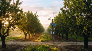
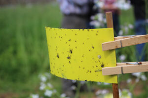
Several tools are already adding new layers to this work. Automated traps from systems like Semios and TrapView capture daily images and counts from pheromone traps. Mobile apps such as Agrio allow scouts to upload photos for quick identification and create georeferenced records. Drone platforms, including Taranis, use high-resolution multispectral imagery to map canopy vigor and stress through indices such as NDVI and NDRE. Predictive models combine trap data, weather and historical patterns to estimate when pest activity may increase.
Building a More Complete Picture
These tools collect a range of information. Trap systems track counts, capture timing and species trends. Mobile apps record photos, locations and scouting notes. Drone imagery reveals spatial patterns of stress, differences in canopy vigor and changes over time. Predictive models combine current observations with temperature, humidity and historical pest pressure to generate forecasts or risk scores. Together, these tools create a more continuous picture than weekly scouting alone.
Improving Field Priorities
Advisors are using this information to adjust how they work in the field. Drone imagery helps prioritize which blocks or sections to visit first rather than walking every block equally. Rising trap counts paired with stress identified through imagery can signal when to increase scouting intensity in a particular area. Predictive outputs help refine timing, such as aligning sampling with expected egg hatch or flight peaks. Some advisors also use the data to support more targeted treatments or evaluate the effectiveness of previous applications.
Recommendations related to timing and placement often improve the most. The additional information helps align interventions with specific pest life stages or favorable weather windows. It can also support decisions to focus on field edges or individual blocks rather than treating an entire ranch uniformly. Scouting recommendations become more precise as well, including when to verify an initial detection or inspect flagged areas for eggs or larvae.
Technology Still Requires Verification
There are clear limitations. Drone imagery identifies plant stress or damage patterns, not the pest itself. The same symptoms may result from insects, disease, water stress or nutrient deficiencies, so ground truthing remains essential. Predictive models perform best when calibrated under local conditions and may miss emerging pest issues or unusual environmental conditions. Cost, connectivity and the time required to review and interpret data are also important considerations. Not every situation justifies the additional layer of technology.
Human expertise remains essential throughout the process. Someone must still confirm what the data are showing, interpret the findings within the context of a specific block and its history, and determine the most appropriate course of action. These tools can identify changes and suggest where to focus attention, but they cannot replace the professional judgment required to evaluate treatment thresholds, resistance management concerns or operational realities.
Technology Supports Experience, It Doesn’t Replace It
What I keep coming back to is that these tools work best when they help us put experienced eyes in the right place with better information. They can show where pest pressure is increasing or where a previous treatment may not have provided uniform coverage. But the final decision still rests with the person who knows the field.
Publisher’s Take
The Big Picture: What to do Next
1. Use drone imagery to prioritize scouting
Focus field time on blocks or zones showing stress rather than scouting every acre with the same intensity.
2. Layer multiple data sources before making recommendations
Combine trap counts, drone imagery, weather data and field observations to improve confidence in pest management decisions.
3. Verify aerial observations in the field
Drone imagery can identify areas of stress, but ground truthing is essential to determine whether insects, disease, irrigation or nutrition are responsible.
4. Align scouting with pest development
Use predictive models and trap data to schedule scouting around expected egg hatch, flight peaks or other critical pest life stages.
5. Let technology improve efficiency, not replace expertise
Use aerial imagery and predictive tools to support professional judgment, while continuing to base treatment decisions on field verification and established economic thresholds.
